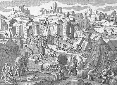
250th Aniversary of the 1755 Lisboa Earth Quake


Images from the Kozak Collection
The earthquake began at 9:30 on November 1st, 1755, and was centered in the Atlantic Ocean, about 200 km WSW of Cape St. Vincent. The total duration of shaking lasted ten minutes and was comprised of three distinct jolts. Effects from the earthquake were far reaching. The worst damage occurred in the south-west of Portugal. Lisbon, the Portuguese capital, was the largest and the most important of the cities damaged. Severe shaking was felt in North Africa and there was heavy loss of life in Fez and Mequinez. Moderate damage was done in Algiers and in southwest Spain. Shaking was also felt in France, Switzerland, and Northern Italy. A devastating fire following the earthquake destroyed a large part of Lisbon, and a very strong tsunami caused heavy destruction along the coasts of Portugal, southwest Spain, and western Morocco.
Shortly after the earthquake struck the great city, a series of huge tsunami waves crashed over the harbor quays, engulfed the lower part of Lisbon on the shore of the Tagus, and submerged much of the lower part of the city - including its newly built, marble quay of Cais De Pedra which disappeared into the river.
The first three of these tsunami waves were the largest and completed the destruction brought about by the two earlier strong quake shocks. 20,000 more of the terrified survivors who had rushed to the open space of the docks and the waterfront quay for safety, lost their lives to these tsunami waves. All boats moored in Lisbon's harbor were destroyed.
See more about the Lisbon Earthquake here and here or here.
Labels: Coisas de Lisboa

0 Comments:
Post a Comment
<< Home